Proactive climate resilience planning for rural electric infrastructure
Vermont Electric Cooperative (VEC), a not-for-profit cooperative serving over 43,000 meters across eight Vermont counties, faces an increasingly urgent reality: extreme weather events are intensifying and threatening their 2,500 miles of overhead distribution lines running through heavily forested, off-road terrain. In 2024 alone, storms Finn and Gerri snapped more than 60 poles and required nearly a week of coordinated recovery efforts.
For VEC, trees and weather-related events now account for nearly 50% of all outage hours and roughly 70% of all outage events. Major storm events require two to four times the typical resource mobilization, and planning investments with legacy systems like Excel spreadsheets was no longer feasible given changing extreme weather complexities. As a member-owned cooperative, VEC needed to stretch every dollar for maximum community value while building resilience against Vermont's changing climate patterns.
gridCAVA gives VEC comprehensive climate vulnerability assessment capabilities designed specifically for municipal and cooperative utilities. The application integrates weather and climate models with VEC's infrastructure data, enabling the cooperative to identify asset exposure, sensitivity, and consequences of various climate hazards at a 5km resolution. This allows VEC to move from reactive recovery to proactive, data-driven resilience planning.
gridCAVA pulled VEC's GIS infrastructure data to identify asset locations and types, then integrated long-range climate models to map hazard exposure across their service territory.
Working with VEC, Rhizome identified which assets have higher vulnerability against different hazard types, particularly snow and ice events that drive many of their outages. Even though snow and ice are compound hazards, driven from the confluence of temperature, precipitation, and wind, Rhizome’s experts were able to model and project snow and ice events with high confidence. gridCAVA overlays exposure layers with asset data to visualize conductors in high-exposure regions and integrates consequence zones to precisely target the most important assets for hardening investments.
Using gridCAVA, VEC developed detailed snow and ice sensitivity mapping across their territory, with red zones indicating higher sensitivity and blue zones showing lower sensitivity areas. Prior to gridCAVA, VEC would prioritize investments based on historical outage data and certain asset characteristics. gridCAVA helped VEC further qualify and target project sites in locations with high hazard potential and where conductor phase configuration and downstream line segments would potentially result in prolonged customer outages.
VEC has formally integrated gridCAVA into their planning processes, featuring the partnership in their 2025 Integrated Resource Plan (IRP) to demonstrate how climate vulnerability assessment advances their capital prioritization beyond historical outage performance to prioritize areas modeled to be more vulnerable in the future. Combined with their other initiatives like strategic relocation and undergrounding, VEC now has a comprehensive approach to building grid resilience while serving their rural communities with equity in mind.
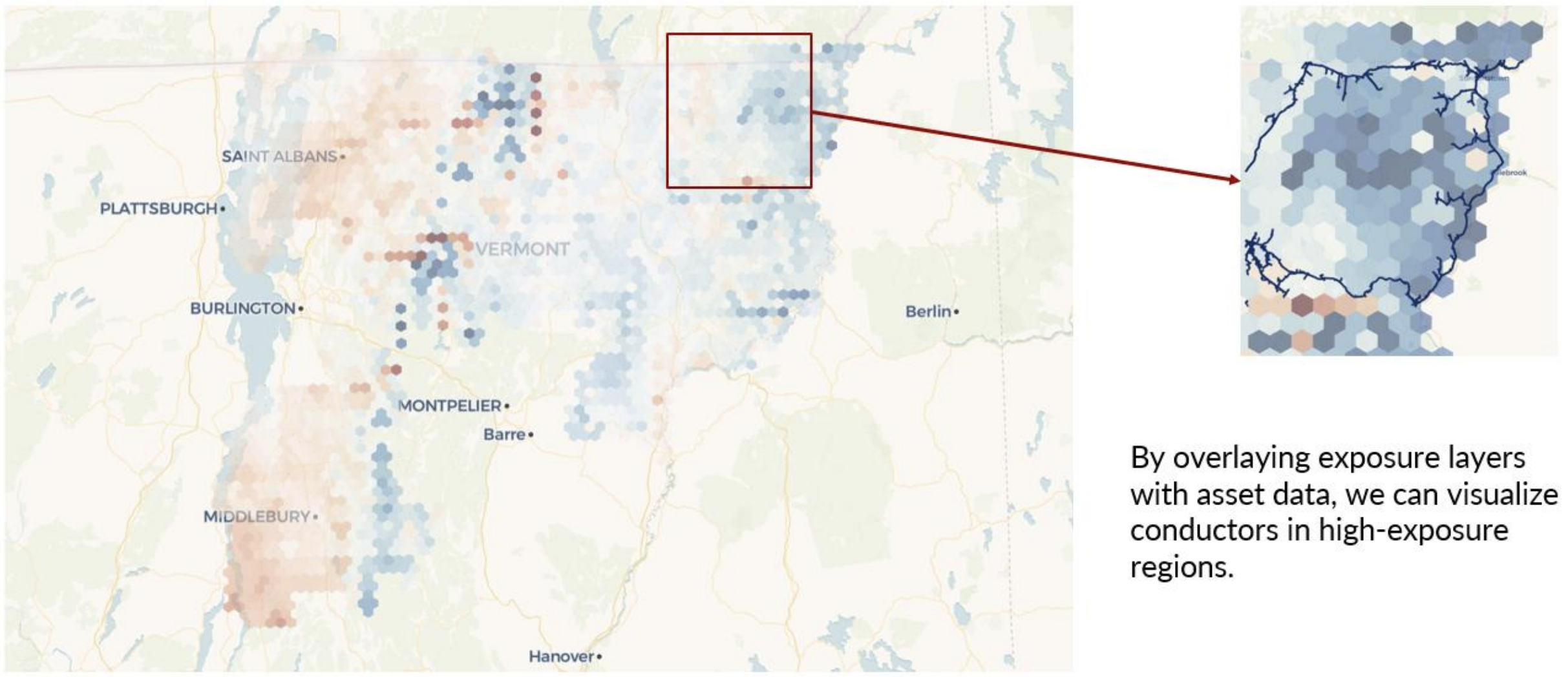
An example of what Rhizome provided to VEC for snow and ice sensitivity in its territory (red is more sensitive and blue is less sensitive), featured in their 2025 IRP
